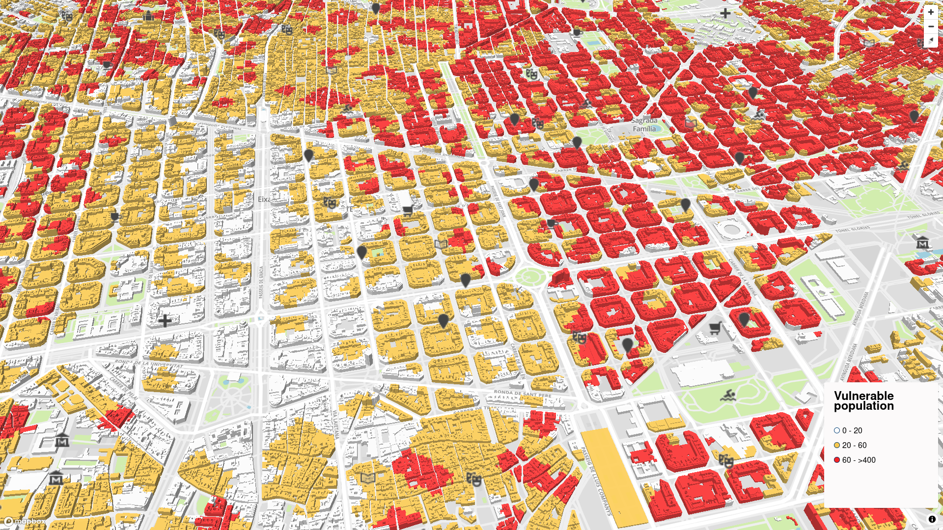
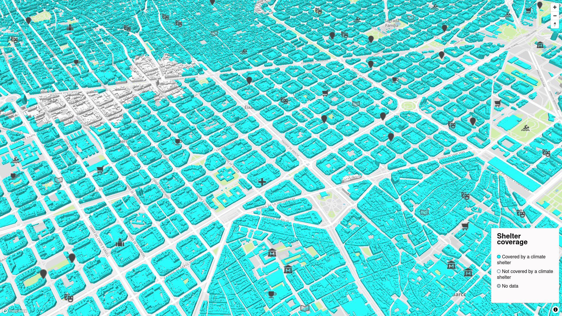
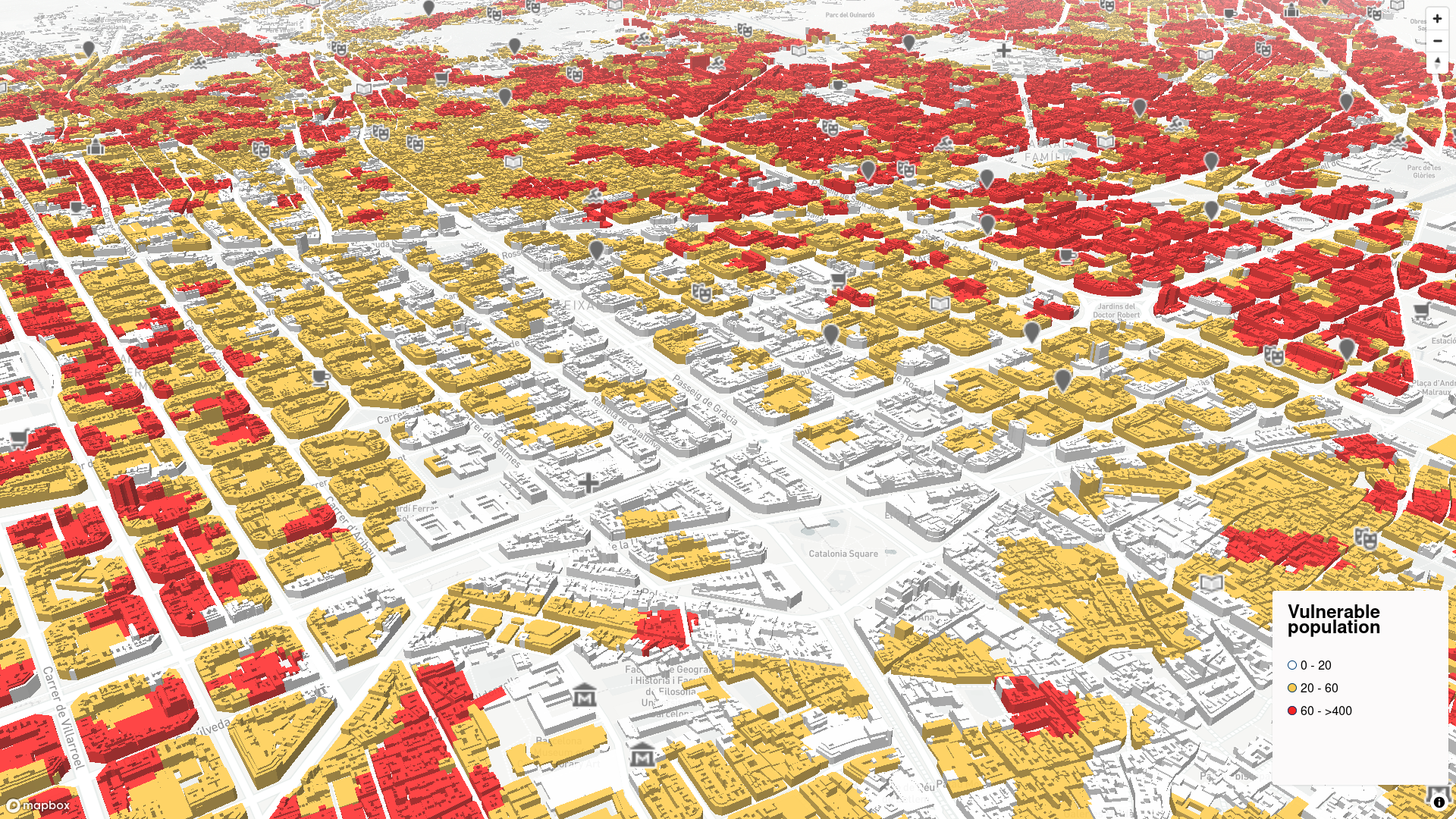
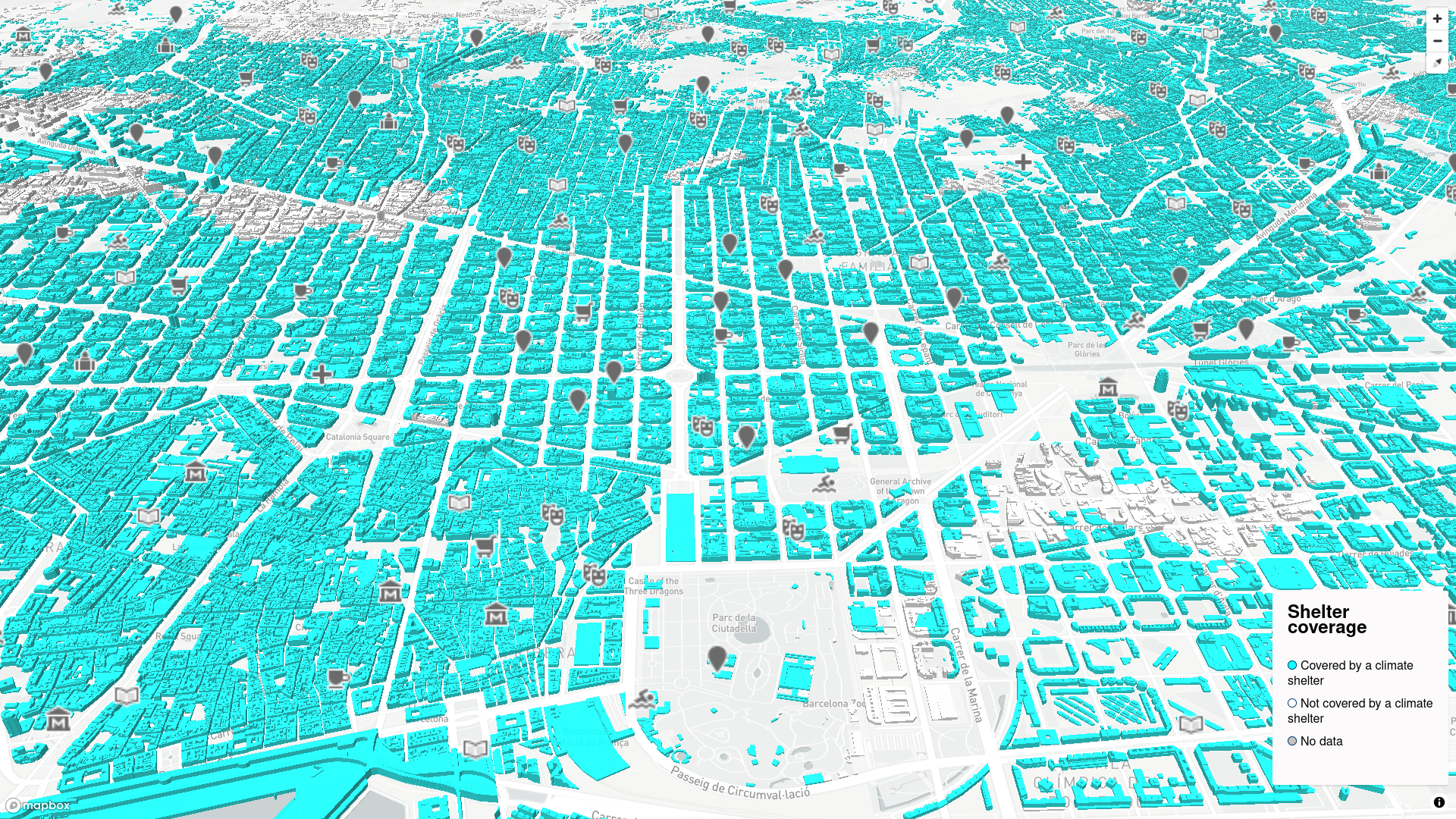
Climate shelters with 3D buildings gallery
Click on a picture to go to the map. There are 2 layers:
- 1) Climate shelter points
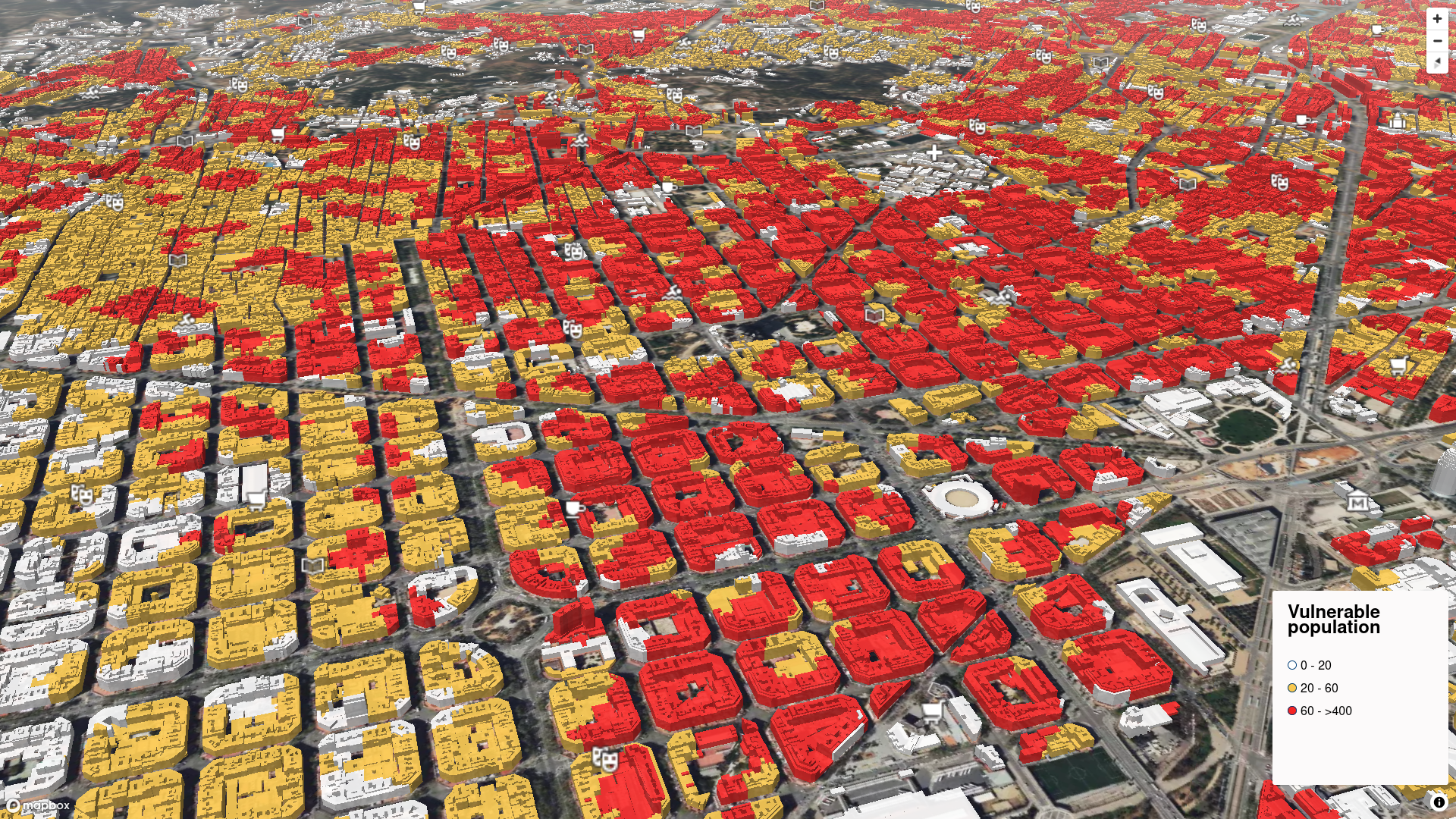
- 2) 3D buildings, represented in 2 different ways,
- a) Vulnerable population
- b) Coverage by climate shelters
There are 3 basemap styles:
- - B = Basic style
- - L = Light style
- - S = Satellite style